Shoreline Boulevard Neighborhood Connector
It’s easy to cross Franklin Street by the city library. The street is so narrow, you’re often comfortable crossing mid-block. In the past, Shoreline Boulevard near Downtown was just as easy to cross, but now you must contend with cars moving at freeway speeds across six lanes of traffic. The road is a rift in an otherwise intertwined collection of homes, parks, and businesses. Put simply, Shoreline Boulevard is incompatible with the neighborhoods that surround it.
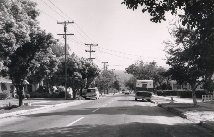
Bailey Avenue (the future Shoreline Boulevard) circa 1965. In 1968, Bailey Avenue was widened to four and six lanes to accommodate additional automobile traffic and an eventual fixed rail system. The devastation to the surrounding neighborhood community was described in a series of articles in the Mountain View Voice in 2002: Part 1 – Part 2 – Part 3
A typical neighborhood street in this area, such as Franklin Street or Mountain View Avenue, is a leafy and generally pleasant place to walk. Parents feel their kids are safe riding bikes. Bringing these qualities to Shoreline Boulevard is difficult but not impossible. The primary challenge with Shoreline Boulevard is its large number of car lanes, which promotes speeding, intimidates people trying to cross the street, and even leads to injuries. Not only is the road oversized for the number of cars that use it, but it’s a barrier for people who are trying to get downtown or enjoy Eagle Park.
Great Streets Mountain View envisions a future South Shoreline Boulevard that has the qualities of a leafy, traffic-calmed neighborhood, while continuing to serve automobile traffic. Reconfiguring South Shoreline Boulevard into a multiway boulevard with four auto travel lanes and two traffic-calmed access lanes will separate fast-moving car traffic from the sidewalk area and the front yards of the homes along the street. This will create a leisurely bicycling and walking environment similar to a neighborhood street in the surrounding area.
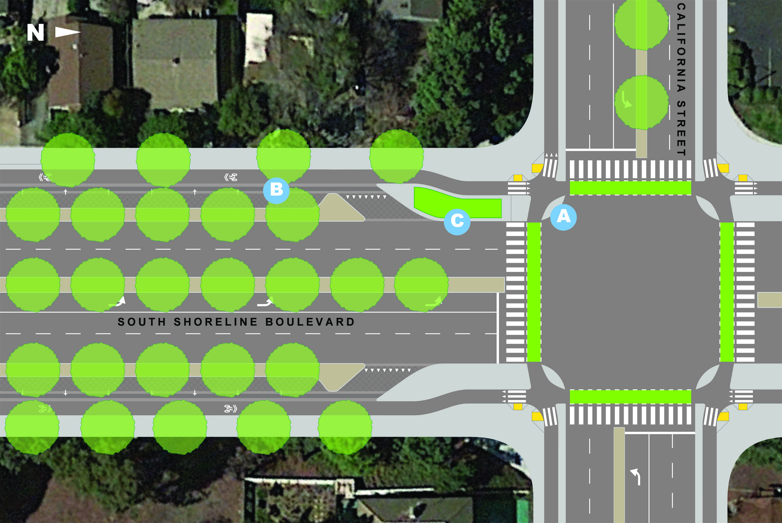
Below is an illustration of the intersection of Shoreline Boulevard and California Street as it appears in our vision. Click on the letters to read more about key elements.


Protected Intersection
Intersections are generally the most dangerous part of a road to navigate on bike. Left turns are challenging and bike lanes frequently disappear in advance of the crossing. One solution that’s common in the Netherlands and recently adopted by the city for the North Shoreline Boulevard project, is the protected intersection. This design maintains the continuity of protected bike lanes through the intersection, improving safety for all.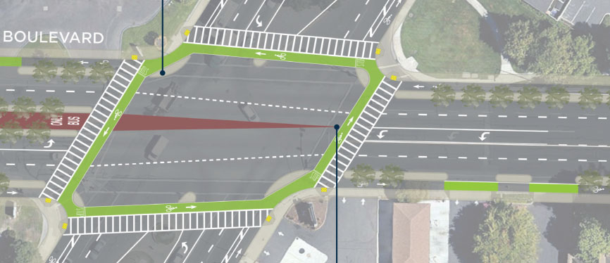
Proposed Middlefiled Rd & Shoreline Blvd intersection. Source: City of Mountain View

Green Street
Rain that falls on the street is funneled straight to the bay, along with accumulated oil, grease, and grime. This pollutes the bay and local creeks. An effective and great solution is a large planter that allows rainwater to filter into the ground and be naturally treated by a mix of hearty plants before flowing to the bay.
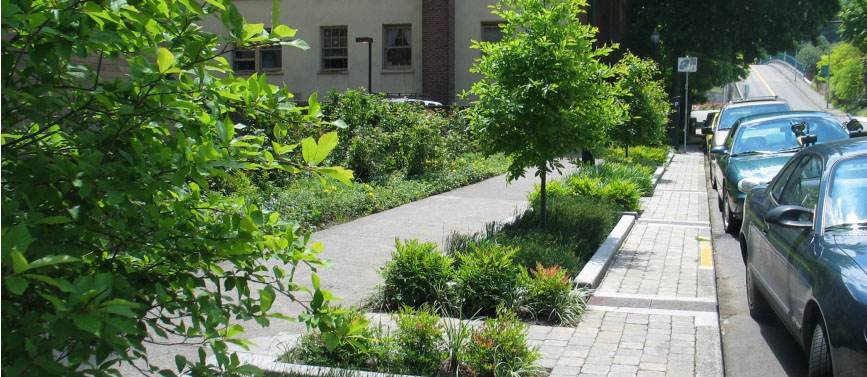
SW 12th Ave, Portland, OR. Source: City of Portland

Multiway Boulevard
The multiway boulevard helps tame traffic and improve bike and pedestrian access on large streets that still must accommodate a large number of vehicles. Key to the design are slow, traffic-calmed access lanes that separate fast-moving traffic from the sidewalk area and front yards of homes. The result is the feeling of being on a slow and pleasant neighborhood street.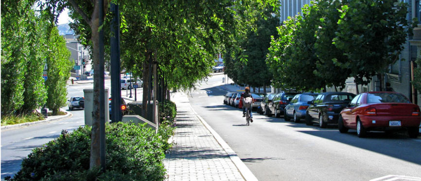
Octavia Boulevard, San Francisco. Source: Steve Boland