Bike Boulevard
A low-speed street (or series of streets) designated by signs as a priority route for bicyclists. Bryant Street in Palo Alto is a good example of an effective bike boulevard: it has various design elements that slow traffic, limit auto access and give travelers on Bryant the right-of-way.
Mountain View has a bike boulevard that extends from San Antonio to Whisman, winding through the Monta Loma neighborhood and then continuing along Montecito, Stierlin, Central Avenue and Gladys. However, it lacks safety features such as those on Bryant Street.
Bike Box
A painted green space on the road with a white bicycle symbol inside, located at an intersection behind the crosswalk but in front of where the cars stop. It allows cyclists to safely turn left by creating space between them and the cars while waiting for the light to turn green. See a video of a cyclist using a bike box in Seattle.
Bike Lanes
See Conventional Bike Lanes, Buffered Bike Lanes, Green Bike Lanes, Protected Bike Lanes
Bike Stairway
A stairway that has a channel alongside it, so people can walk a bicycle up or down the stairs.
Bollards
Short vertical posts that can be arranged in a line to separate traffic from pedestrians, or to keep cars out of an area.

Two bollards protect a fire hydrant at Evelyn Ave. & Bush St. Source: GSMV
BPAC (Bicycle Pedestrian Advisory Committee)
A volunteer committee that advises the city of Mountain View on bike/ped issues and infrastructure. Learn more on Mountain View’s BPAC homepage.
BRT (Bus Rapid Transit)
The general term BRT refers to any bus transportation system that provides enhanced, more efficient service than regular bus lines. The BRT plan envisioned for El Camino Real includes two dedicated center bus lanes with bus stops in the median (similar to a light rail system) along with bike lanes and many other enhancements such as more frequent service, better pedestrian crossings, low-emissions buses and free WIFI. Learn more on the Valley Transportation Authority website.
Buffered Bike Lane
This is a bike lane with a painted area designating a space between the motor vehicle travel lanes and cycling lane. Sometimes these are augmented with plastic “roll over” posts which increase visibility of the buffered area, but do not provide a hard barrier between the lanes.

Buffered Bike Lane on Moffett Boulevard. Source: Safe Mountain View
Bulbout
A section of sidewalk that extends into the street area, to reduce the crossing distance for pedestrians and/or reduce traffic speeds. Bulbouts at the corner of Calderon and Mercy make it easier and safer to cross the street there.

Curb bulbout (on the right) at Calderon & Mercy. Source: GSMV
Chicane
A chicane is two staggered bulbouts, one on each side of the street, that slow down traffic by acting like small bends in the road. A bike/ped chicane is two staggered fences or barriers that make people slow down or dismount their bikes, often placed at trail entrances/exits.

Traffic-calming chicane. Source: Wikipedia

Bike/Pedestrian chicane at the bottom of the ramp from the Stevens Creek Trail bridge over Hwy 85, at Dale Ave. & Heatherstone Way. Source: GSMV
CIP (Capital Improvement Program)
A set of major projects to upgrade city infrastructure, chosen every two years by the Mountain View City Council. The 2013-2014 CIP list includes $250,000 for a safety study of California Street and Escuela Avenue, thanks in part to GSMV’s advocacy.
City Council Study Session
An open City Council meeting at which public input is taken but no decisions are made.
Complete Streets
Well-designed, attractive streets that are safe and pleasant for all — including pedestrians, bicyclists, motorists and transit riders of all ages and abilities. This is what GSMV is working for! Learn more about the national movement for complete streets at http://www.completestreets.org.
Conventional Bike Lane
This is a bike lane with a painted area designating a cycling lane beside the motor vehicle travel lanes. This is by far the most common bike facility in Mountain View.

Conventional Bike Lane on Moffett Boulevard. Source: Safe Mountain View
CTC (Council Transportation Committee)
A committee composed of three city council members that makes transportation-related policy recommendations to the City Council.
Curb Bulb / Curb Extension
see Bulbout
Cycle Track
See Protected Bike Lane
Diverter
A curb or planter that redirects car traffic to different routes while providing space for through travel of pedestrians and bicyclists.
Diverter at Bryant St. & Embarcadero in Palo Alto. Source: GSMV
Easement
Special permission granted by a property owner to use her/his land for a specific purpose, such as the construction of utilities, sidewalks or roadways.
EIR (Environmental Impact Report)
A report on the projected environmental effects of a new project or regulation, often required by cities or other governmental bodies in order to help decide whether to go ahead with the project or regulation.
EPC (Environmental Planning Commission)
A seven-member committee appointed by the Mountain View City Council to formulate and recommend development plans for the city. Learn more at Mountain View’s EPC homepage
General Plan
The guiding document that contains the long-term vision, policies and goals for Mountain View’s physical development and preservation. Read Mountain View’s General Plan
Grade Separation
This refers to when trains and road vehicles cross each other on separate levels, via overpasses or underpasses. For example, San Antonio Road crosses over the Caltrain tracks.
Grand Boulevard Initiative
A regional collaboration dedicated to revitalization of the El Camino Real corridor running through San Mateo and Santa Clara Counties. Learn more at http://www.grandboulevard.net.
Great Streets
see Complete Streets
Green Bike Lanes
Green bike lanes use green paint or green paving across the width of the bike lane, with white line striping on either side to differentiate the bike lane from motor vehicle lanes. The paint is dashed where motor vehicle traffic may cross the bike lane, such as in merging areas and intersections.
Left Turn Box for Bikes
see Bike Box
MTMA (Mountain View Transportation Management Association)
A nonprofit organization formed in 2013 by Google, Intuit and two private development companies, to create programs to reduce traffic congestion in the North Bayshore area. It will run shuttle buses for major employers, and is also required by the city to run a free public shuttle service to and from downtown. More companies, as well as the city, are expected to join MTMA in the near future. Read the city council’s MTMA report.
Multiway Boulevard
Multiway boulevards separate through travel lanes from local access lanes to simultaneously move vehicles while providing a calm, spacious pedestrian and living environment for adjacent residences. Octavia Boulevard in San Francisco was built as a multiway boulevard to replace the earthquake damaged elevated Central Freeway.
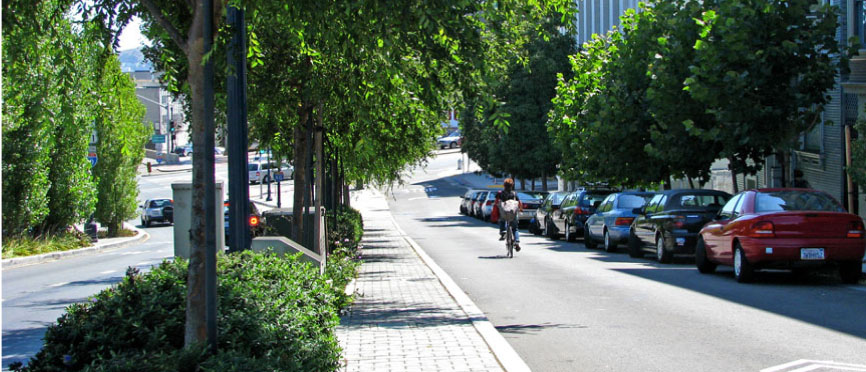
Octavia Boulevard in San Francisco
Precise Plan
A document containing specific development guidelines and regulations for a particular area in the city. View Mountain View’s Precise Plans for 32 areas
Protected Bike Lane
A protected bike lane is an exclusive bike lane which is typically positioned within the roadway but is physically separated from motor traffic (typically by curbs, bollards, parked cars, or planters) and is distinct from the sidewalk. Sometimes called a Cycle Track.

A protected bike lane. Source: Streetsblog USA
Refuge Island
A small section of pavement or sidewalk completely surrounded by road materials where pedestrians can stop before finishing crossing a road. Also called a Pedestrian Refuge or Pedestrian Island. It is typically used when a street is very wide, as the pedestrian crossing can be too long for some individuals to cross in one traffic cycle.
Road Diet
A popular term for a road improvement that typically includes removing one or more lanes from the street and adding bike lanes, bulbouts, and a center left turn lane, resulting in calmer traffic. California Street and Shoreline Boulevard are two possible candidates for road diets.
Serpentine Ramp / Switchback Ramp
A ramp that zigzags back and forth.
Setback
The distance a building or structure is from a street, right-of-way or property boundary. City zoning laws and municipal codes specify minimum setbacks for buildings depending on their type and location.
Sidewalk Curb Extensions
see Curb Extensions
TDM (Transportation Demand Management)
A general term for strategies that increase transportation efficiency by encouraging a shift from drive-alone trips to other transportation modes. TDM strategies include information and education, incentives (such as free bus passes), infrastructure improvements (such as bike lanes, improved bus service and mixed-use development near transit stops), technology, and pricing.
TMA (Transportation Management Association)
A general term for an organization devoted to developing and coordinating Transportation Demand Management strategies among different cities, companies or organizations. MTMA is the Mountain View TMA.
TOD (Transit-Oriented Development / Transit-Oriented Design)
A walkable mixed-use residential and commercial area near a transit station (train station, metro station, tram stop, or bus stop). Mountain View has transit-oriented development near the San Antonio and Downtown Caltrain stations.
Traffic Calming
Slowing down traffic by using things like reduced speed limits, narrowed lanes, speed humps, traffic circles, curb extensions (also called bulbouts), raised pedestrian crossings, etc.
Two-Stage Left Turn Box for Bikes
see Bike Box
VTA (Valley Transportation Authority)
Santa Clara County’s transportation agency. It provides bus, light rail, and paratransit services; designs and constructs pedestrian, bicycle and highway improvement projects; and participates as a funding partner in regional rail service. It operates under a Board of Directors composed of county and city representatives.
Wheeling Channel / Wheeling Ramp / Wheel Trough
The channel or ramp next to a stairway that lets people walk their bikes up and down the stairs.